Taranis
AI-powered leaf-level crop intelligence platform for advisors and growers
- Also known as
- taranis
What is Taranis?
A web-based service that analyzes drone-collected imagery using machine learning to help agricultural advisors and growers understand crop health conditions, identify diseases and pests, and make evidence-based recommendations to optimize yields and input management.
Taranis pricing
We don't have Taranis's full plan breakdown yet (its pricing page resisted automated reading). Here's what we could confirm. Always check live pricing for exact numbers.
What Taranis does
The capabilities that matter for precision agriculture, normalised so it lines up with every alternative. “-” means we haven't confirmed it, not that it's missing.
- Deployment model
- Cloud spatial engine
- Variable rate technology vrt prescription maps
- -
- Ndvi satellite and drone imagery ingestion
- ✓
- Isobus tractor monitor file export generation
- -
- Soil sample data interpolation and layering
- -
- As planted and as applied machine data sync
- -
- AI crop disease and pest identification scouting
- ✓
- Drone orthomosaic mapping and stitching engine
- ✓
- Water management and irrigation sensor telemetry
- -
- Topographic 3d elevation drainage modeling
- -
- SOC2 type ii
- -
- ISO 27001
- -
- Pricing model
- -
Platform & deployment
Independently observed- Web
- Cloud / SaaS
Integrations (3)
Independently observed- Syngenta Crop Protection
- Nutrien Ag Solutions
- Syngenta
Taranis FAQ
Common questions about Taranis, answered from independent, dated evidence.
What is Taranis?
A web-based service that analyzes drone-collected imagery using machine learning to help agricultural advisors and growers understand crop health conditions, identify diseases and pests, and make evidence-based recommendations to optimize yields and input management. It is indexed under Precision Agriculture.
Source: https://www.taranis.com/
What platforms does Taranis support?
We have confirmed browser-based access to Taranis. That is the extent of what we could verify from public sources, so it may well offer desktop or mobile clients we have not indexed.
Source: https://www.taranis.com/
Can Taranis be self-hosted?
We have only confirmed a cloud / SaaS deployment for Taranis, so it appears to be vendor-hosted. If a self-hosted option exists we have not found it documented publicly.
Source: https://www.taranis.com/
Taranis alternatives
Other precision agriculture we track, ranked by the same independent score.
- Climate FieldViewCloud-based platform for accessing field data to inform better farming decisionslow · 46%
- OneSoilPrecision agriculture platform combining field monitoring, AI-assisted insights, and variable-rate application mappinglow · 48%
- WebODMOpen-source drone mapping software for generating aerial maps and 3D models from drone imagerylow · 7%
- Hummingbird TechnologiesLocal managed IT services and cybersecurity support for Texas and Oklahoma businesseslow · 8%
The vioscaleAI score: one lens on the evidence
Not user reviews and not a paid placement: a confidence-weighted blend of the independent signals below (adoption, activity, security posture, and more), which you can sort and re-weight yourself. Vendors can correct their listing but can never move their rank, and stars are weighted low as a vanity metric. It is one way to read the evidence for Taranis, not the verdict.
| Signal | Score | Weight | Contribution | Evidence |
|---|---|---|---|---|
| Capabilities | 58 | 0.04 | 2.5 | ✓ |
| Integrations | 14 | 0.05 | 0.7 | ✓ |
| Price level | 0 | 0.10 | 0.0 | - |
| Reliability | 0 | 0.06 | 0.0 | - |
| Security posture | 0 | 0.04 | 0.0 | - |
| Pricing transparency | 0 | 0.09 | 0.0 | - |
Computed . Re-weight it by intent, or see the full method.
All data & sourcesshow ↓
Every value we hold, with its source, retrieval date, and confidence. This is the evidence behind the score: don't trust it, verify it.
Content
| Attribute | Value | Evidence |
|---|---|---|
| Faq | 3 items | mediumsource · 2026-09-10 · 60% |
Features
| Attribute | Value | Evidence |
|---|---|---|
| Capabilities | Deployment model: cloud_spatial_engine · Ndvi satellite and drone imagery ingestion: Yes · Drone orthomosaic mapping and stitching engine: Yes · Ai crop disease and pest identification scouting: Yes | mediumsource · 2026-10-07 · 60% |
Integrations
| Attribute | Value | Evidence |
|---|---|---|
| Count | 2 | mediumsource · 2026-10-07 · 60% |
Pricing
Is Taranis the right choice for you?
Tell us the job, the constraints and what you weigh most, and we will rank Taranis against the rest of the precision agriculture we index, using the same dated evidence weighted your way.
Free to run, no account needed to start. How the evaluation works
Is this your product?
This profile was built from public sources without asking you. You can take the badge below and use it anywhere, and you can claim the profile to correct anything we got wrong. Both are free, and neither moves Taranis up or down: nobody can buy rank here, including you.
Take the badge
Live, always current, and free to use on your own site. It shows Taranis's independent score and links back to this profile.
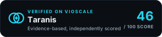
<a href="https://www.vioscale.ai/software/taranis" target="_blank" rel="noopener">
  <img src="https://www.vioscale.ai/badge/software/taranis.svg" alt="Taranis, verified on vioscaleAI" width="330" height="76" loading="lazy" />
</a>
Markdown, for a README →
[](https://www.vioscale.ai/software/taranis)Claim the profile
Verify you control the domain, then point us at the pages that state the facts about Taranis and add your own description and media. Free, and it does not change the score.
- Correct anything wrong, with evidence
- Point our crawler at the pages that matter
- Write your own description and add media
Not the owner? How vendor profiles work